an introduction to the tiwi
how it all started
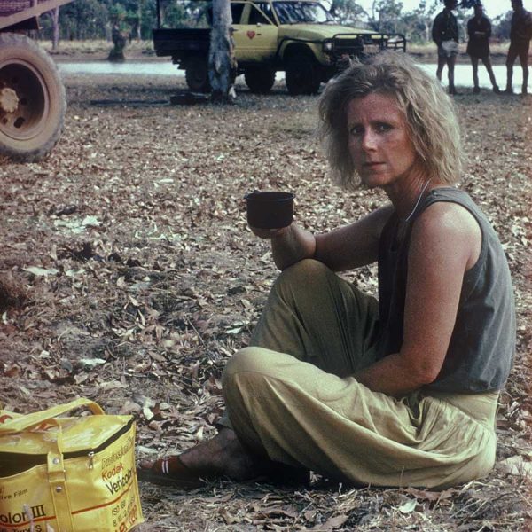
In July 1987, I flew to Darwin to meet the skipper of the Trisha Kate, a roll-on barge supplying isolated settlements in the Arafura Sea. The skipper was the legendary, now late, George Haritos, who knew the tricky waters around the islands like the back of his hand. He had many tales to tell. I signed up as a cook and bottle washer on the barge. We visited Croker Island, Maningrida, Millingimbi, Ramangining, Buckingham River, Elcho Island and the Tiwi islands, before returning to Darwin. With the help of hunter Simon Kyle-Little, I photographed a buffalo round-up at Goodparla Station, and crocodiles in the Alligator Rivers.
my first visit to the tiwi islands
I had a permit to visit the Tiwi islands, so I then flew to Nguiu on Bathurst Island. I only stayed a week, but that was enough for me to make up my mind. I had seen many strange and fascinating sights during my travels through the “top end”, but it was the Tiwi Islanders who captured my heart. I wanted to know them better, and I wanted to produce a photographic portrait of the people.
the tiwi islands
The Tiwi islands were once known as the Sentinel Islands, because of their strategic location 60 kilometres north of Darwin in the Timor Sea. The most easterly of the two, Melville Island, covers 5,788 square kilometres, and Bathurst Island 1693 square kilometres. They are the largest Australian islands after Tasmania, so large in fact, that they create their own distinct regional weather pattern within the tropical monsoonal zone. Annual rainfall in the northwest of the islands approaches 2000 mm, the highest in the Northern Territory (NT), whilst on the east coast of Melville Island it can be less than 1400 mm. As a result there are abundant fresh water springs on both islands, which together with numerous bores in the townships provide ample drinking water. The daily temperature range is from 19 C to 36 C depending on the season, although it can be colder inland. A feature of the north Australian coastline is the high tidal range, which on the Tiwi Islands can reach seven metres.
The seasons
There are two major seasons, the wet which is hot, humid and cyclonic, and the dry which is cool, and yes, dry. The Tiwi describe the seasons according to the many natural events which occur during the year. Thus the wet season is called Jamutakari, the season of rains. As the grass dries, it is burnt off and fresh shoots appear, attracting the wallabies to the cleared areas where they can be more easily hunted. This period is called Kumurrupuni, the season of smoke. At the hottest time of the year the cicadas appear, deafening everyone with their singing, an event the Tiwi aptly call Tiyari, the season when the cicadas are heard. Territorians call the period leading up to the wet season “the build up”, a particularly hot, humid, and unpleasant time, when tempers fray and much beer is consumed. The Tiwi call it Pumwanyingari – the season of thunder.
nature
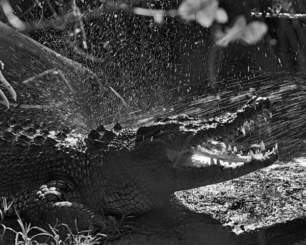
Clear warm seas rich in fish and other marine creatures are flanked by large stands of mangroves, rocky headlands and beautiful clean white sandy beaches. Some of those “creatures” include crocodiles (salties), box jellyfish and sharks, so swimming in the sea can be deadly. Fortunately, there are a number of fresh water swimming holes on both islands, which are very popular with young Tiwi. The northern coast-lines of both islands are home to dugongs and marine turtles, both of which are currently protected as part of a conservation programs involving Tiwi marine rangers.
The islands are generally low-lying with numerous shallow lakes, swamps, and mangrove-lined tidal inlets. However on Melville Island, there is a timbered sandstone range 160 metres high, running for a hundred kilometres west to east, which drains predominantly to the north. Vegetation cover varies from shrubby timber to areas of dry and wet rain-forest, rich stands of eucalyptus, and commercial plantations of cypress pine and acacia on Melville Island.
Wild pigs, dingoes, snakes and wallaby are plentiful on both islands, with water buffalo and geese completing the menu on Melville, which is also home to mobs of fine looking wild-horses. They are reported to be descendents of the whalers which carried the Australian Light Horse in the desert campaigns of the First World War, and were quarantined on the island on their return to Australia.
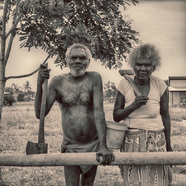
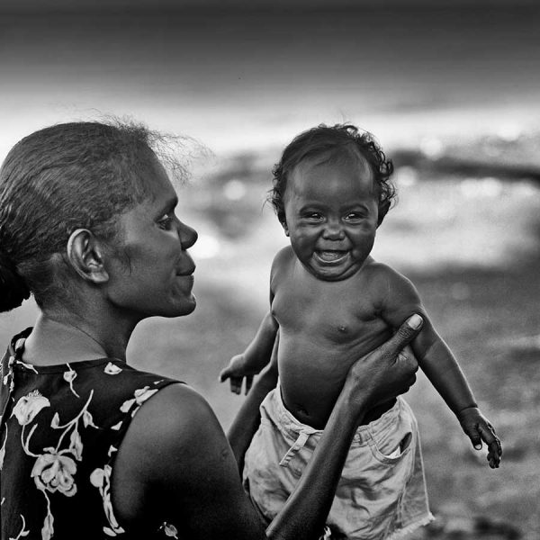
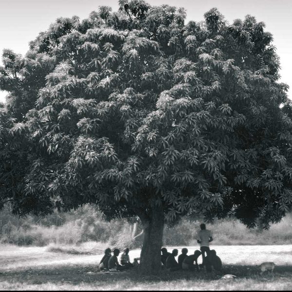
the people
The Tiwi people have lived on Bathurst and Melville Islands for over 50,000 years, separated from the mainland, since the end of the last ice age 12,000 years ago. They developed a separate language, and a culture which differs in many ways to Aboriginal culture in the rest of Australia.
Less than one hundred years ago, the Tiwi were hunter gatherers living in small family groups (bands); there were no villages, in fact there were no permanent settlements of any sort. Today the Tiwi are firmly ensconced village-dwellers. There are now almost 2,700 Tiwi, largely congregated in three communities. Nguiu on Bathurst Island is the largest with a population of 1600. On Melville Island, 450 Tiwi live at Pirlangimpi, formerly known as Pularumpi or Garden Point, while another 600 live at Milikapiti (Snake Bay). Other small communities have settled at Wurankuwu on Bathurst Island, and at Paru on Melville Island.
to learn more
The information above, was taken from my second Tiwi book, “Portrait of a People – The Tiwi of northern Australia” first published in 2008. Although it is first and foremost a book of my photographs of the Tiwi and of Tiwi life, it is more than just a picture book, in that it also relates the history, and describes the customs, lifestyle and culture of the Tiwi. I maintained a diary of my experiences with the Tiwi, and some of the stories of those adventures have been included. Obviously many things have changed in the meantime, but hopefully it will provide you with a little background on the people that I am proud to call Ngiya Mamanta Tiwi.
Viewers should be aware this site contains references to, and images of deceased people